Google Earth's new Timelapse feature shows four decades of planetary change - Android
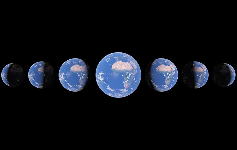
Google compiled more than 24 million satellite images from 1984 to 2020 to create the Timelapse experience.

What you need to know
- Google Earth has gained a new feature called Timelapse.
- The feature allows users to "watch time unfold" and see how our planet has changed over the last four decades.
- Timelapse in Google Earth shows the rapid change on our planet through five themes: forest change, urban growth, warming temperatures, sources of energy, and fragile beauty.
Google Earth is undoubtedly the best Android app for exploring our planet. It lets you virtually fly through cities, peek at natural wonders like Mount Everest, and even enjoy guided tours with Voyager. Google has now announced the biggest Google Earth update in years, enabling users to see how our planet has changed over the last few decades.
Rebecca Moore, Director, Google Earth, Earth Engine & Outreach, wrote in a blog post:
With Timelapse in Google Earth, we have a clearer picture of our changing planet right at our fingertips — one that shows not just problems but also solutions, as well as mesmerizingly beautiful natural phenomena that unfold over decades.
Google Earth's new Timelapse feature lets you "watch time unfold and witness nearly four decades of planetary change." Google says it compiled 24 million satellite photos from the last 37 years to create the interactive 4D experience. The search giant plans to update Google Earth every year with new Timelapse imagery throughout the next decade to "ground debates, encourage discovery and shift perspectives about some of our most pressing global issues."
To get started with Timelapse in Google Earth, head over to the dedicated Timelapse experience site. You can type the name of any place where you want to see time fly in the search bar. Alternatively, you can open Google Earth and access Timelapse via Voyager by clicking on the ship's wheel to watch interactive guided tours. Google currently offers over 800 Timelapse videos in 2D and 3D on its Developers website and on the Google Earth YouTube channel.
15/04/2021 02:44 PM
'F1 2021' is coming to PlayStation, Xbox and PC on July 16th
15/04/2021 07:35 PM
Android 11 file manager apps can request device’s file access starting May
15/04/2021 05:10 PM
Google Earth's biggest update in years adds free 3D timelapse videos
15/04/2021 03:00 PM
T-Mobile gives customers more 5G speed and coverage than any other carrier
15/04/2021 06:33 PM
DJI's new ultraportable drone is a sleeper camera powerhouse
15/04/2021 03:51 PM
Motorola unfolds a very late update for a phone you probably forgot existed
15/04/2021 04:02 PM
Surprisingly, this Google app is better on iOS than on Android
15/04/2021 10:30 AM
TCL teased a phone that both folds and rolls, and I totally love it
15/04/2021 03:21 AM
- Comics
- HEALTH
- Libraries & Demo
- Sports Games
- Racing
- Cards & Casino
- Media & Video
- Photography
- Transportation
- Arcade & Action
- Brain & Puzzle
- Social
- Communication
- Casual
- Personalization
- Tools
- Medical
- Weather
- Shopping
- Health & Fitness
- Productivity
- Books & Reference
- Finance
- Entertainment
- Business
- Sports
- Music & Audio
- News & Magazines
- Education
- Lifestyle
- Travel & Local


